Horseshoe Meadows to Rock Creek (PCT mile 760)
(14 miles, +1900/-2200 feet).
It’s a record snowfall year in the Sierra and I have been dying to get out there and see it for myself. None of my hiking buddies were free this week, so I decided to set out on my own to tackle the highest point on the PCT: Forrester Pass.
My friends and family were a little worried about me doing this trip solo (especially when they saw me pack my ice axe!) so I borrowed a Garmin InReach from my friend BarnFinder. It allows two-way texting via satellite for emergencies and also just to check in from time to time.
My plan is to hike 50 miles in 4 days. Normally that wouldn’t be a problem at all, but the combination of snow and high elevation slows everyone down a lot, usually to about half their normal speed in dry, flat, low altitude conditions. Since I am comfortable with 25 mile days on the easier parts of the PCT, 12.5 mile days seemed like a good guess for this trip, and I packed an extra day of food just in case.
I was a little worried about this trip, but recent reports on the Facebook 2017 PCT group made me feel like it was doable, even with my lack of experience with snow. And today was a pretty good day.
I started at the Eastern Sierra Interagency Visitor Center to get my permit. This is where people enter the same-day lottery for climbing Whitney and it is usually a zoo in the summer. But this year I was the only one there, presumably because the record snowpack has scared people away (which is reasonable, given that a woman recently died up there).

After getting my permit I drove to Onion Valley to leave my car where I would end my hike. I chatted with some thru-hikers while I waited for my shuttle. They were happy to be headed for town, and it was great to get some details from them about conditions.
They made me feel more confident about the trip, though they did seem a little worried about my traction device choice. They brought full crampons, but I decided to bring Kahtoola Microspikes, which are lighter but have smaller and fewer teeth to grip the ice. I told them I had an ice axe, so I would be okay, but I wondered if that was right.
I asked them about Forester Pass, and they said it went fine, but one of the thru-hikers said he felt like Kearsarge Pass was even tougher.

The lovely and learned Paul Fretheim from East Side Sierra Shuttle arrived at 10am to drive me to Horseshoe Meadows where I would begin my hike. He regaled me with local history and the politics of water in the Eastern Sierra for our hour-ish drive.
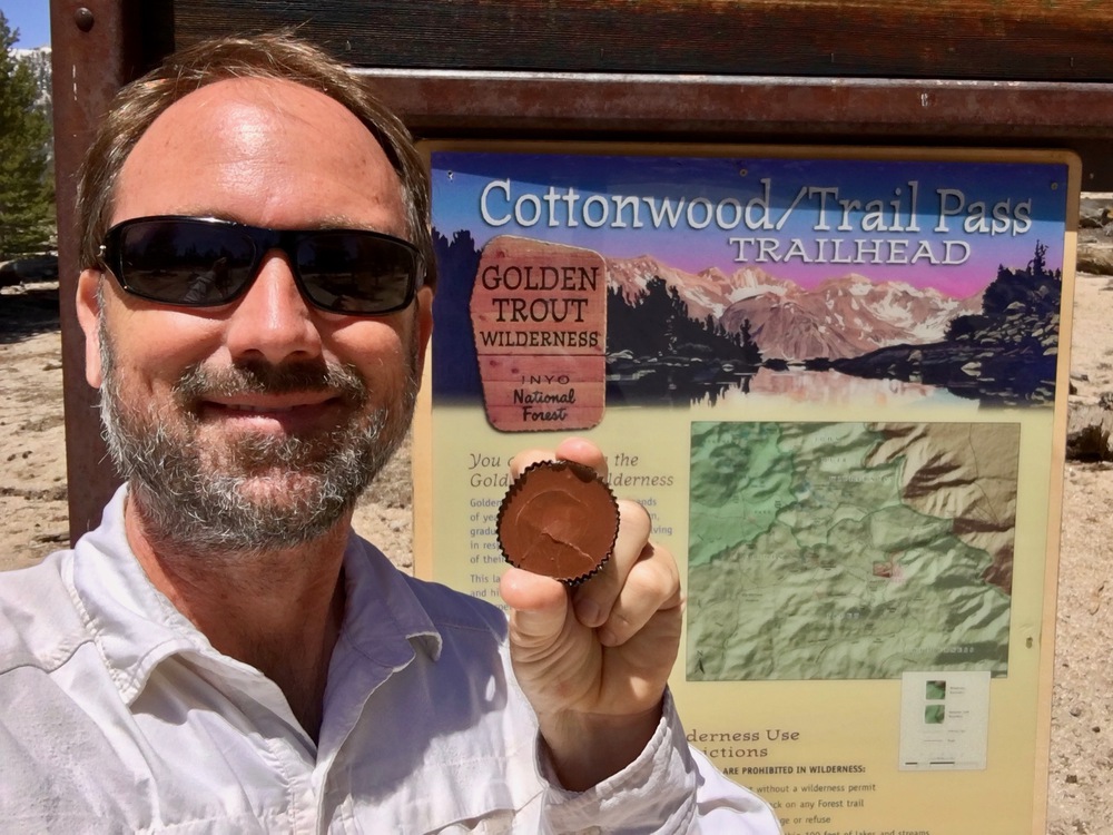
The gate to Horseshoe Meadows is still locked, but it was only a half mile walk from there to the trailhead where I ate a snack before heading out.

To my surprise, the snow was already receding at 10,000 feet and much of the trail was dry.


But not surprisingly, snow did appear and became steady at around 10,500 feet.

Instead of sticking to the trail, I went cross country to avoid much of the snow until the last 100 feet or so of elevation gain before Cottonwood Pass.


I found some thru-hikers at the pass taking a break. I chatted for a bit with Windbreaker, but I worried about lingering too long because I wanted to make it to Rock Creek today. That meant I needed to cover 10 more miles in about 6 hours.


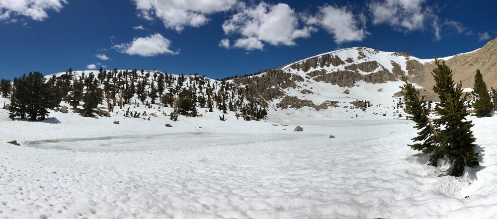
Soon I was off and headed for Chicken Spring Lake. From here for the next few hours it was solid, slushy snow. I just walked in my regular trail runners, so my feet were soaked but not cold.
Although the trail was hidden, there were numerous footprint trails that helped me to stay near the PCT.


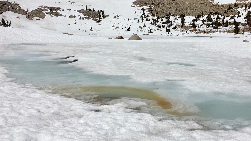
The views started to get really beautiful and soon I was at Chicken Spring Lake.


I decided to climb straight up to the ridge above the lake and it got so steep I needed my ice axe and microspikes for the first time.


But once over the ridge the trail got dry again and I had to put my ice tools away for a bit.


But soon it was back into the snow.

Using my GPS, I looked for the sign that indicated the boundary of Sequoia National Park (I’ve seen it before) but it must have been buried beneath me somewhere. I pressed on toward a meadow called the Siberian Outpost where I would cross my first snow bridge.


The PCT goes up and down through the forest here, and what I am learning about snow is that there are these annoying 6 foot piles of snow everywhere that you have to climb up and down, too. So I shortcut some of that by walking across the Siberian Outpost.


Once across the meadow, I started heading downhill towards Rock Creek. I didn’t take many pictures because I was tired and new to the process of hiking down in slushy snow. I made the mistake of following some footprints made by a person who is very good at boot skiing. I’m not, so I fell a lot!
At about 10,000 feet dry patches appeared.

At Rock Creek there was an unoccupied Ranger Cabin that made a nice stop for the night. I found a patch of dry ground nearby, set up my tent, and collapsed for the night.

Well there you are! Great read and captivating photos! You are smack dab in the heart of my most loved place of all, the Eastern Sierra. Rock Creek? I feel faint now. I just SHARED this on my Facebook page.
Off to read your next chapter!
Stay safe!
Janet Good
LikeLiked by 1 person
Really enjoyed the story and pix. Stay safe!
LikeLiked by 1 person