25-26 May 2024
Covington Flats to California Riding and Hiking Trail to cross-country to Samuelson Rock to West Entrance to Bigfoot Trail to California Riding and Hiking Trail to Covington Flats
(28 miles, +4,000/-4,000 feet).
I had such a nice time with my parents in Joshua Tree that I decided to go back!
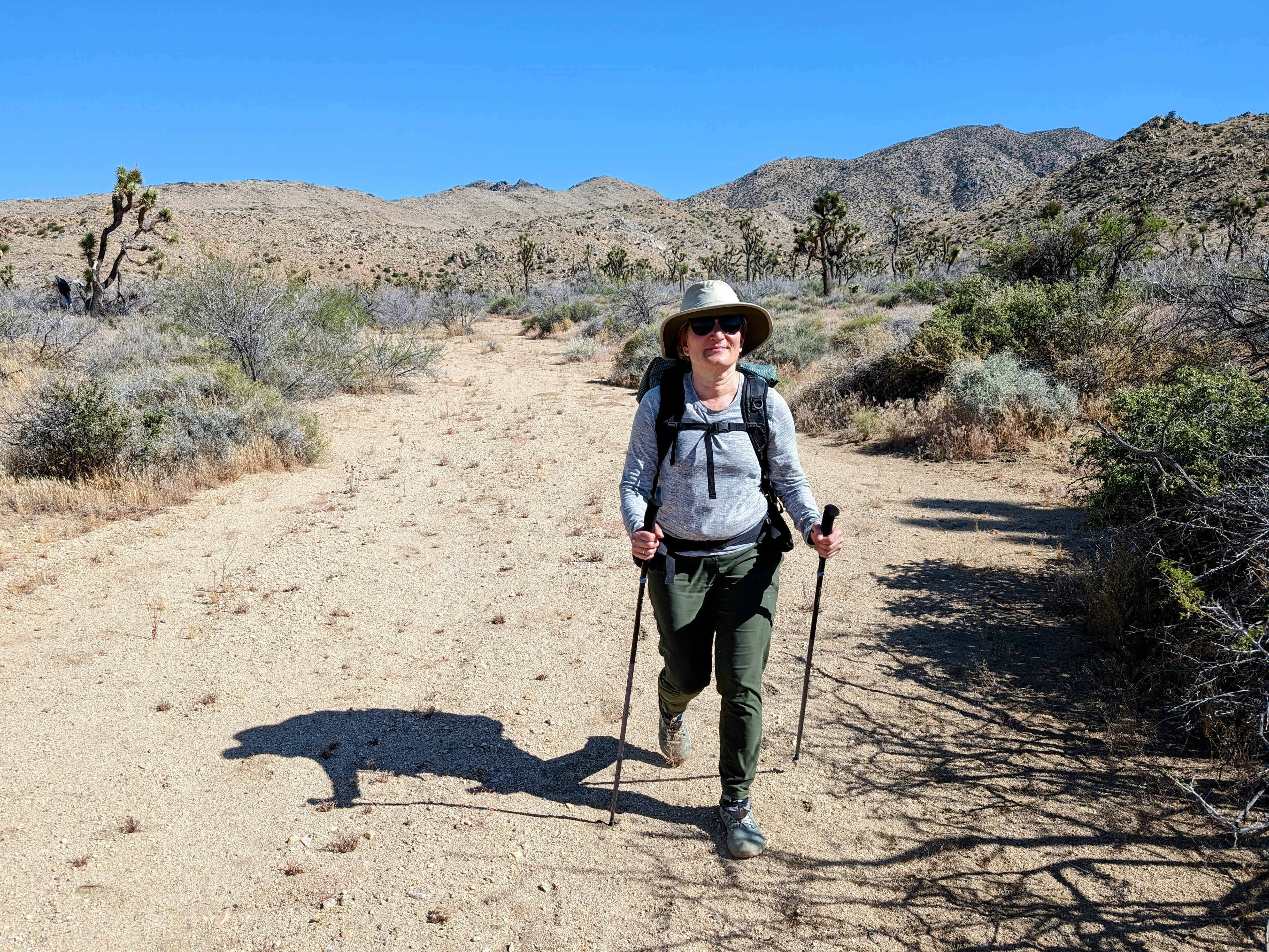
This time on a one night backpack with Half Cookie.
Whee!
![pxl_20240525_1653452402](https://jimmyjamhikingclub.com/wp-content/uploads/2024/05/pxl_20240525_1653452402.jpg)
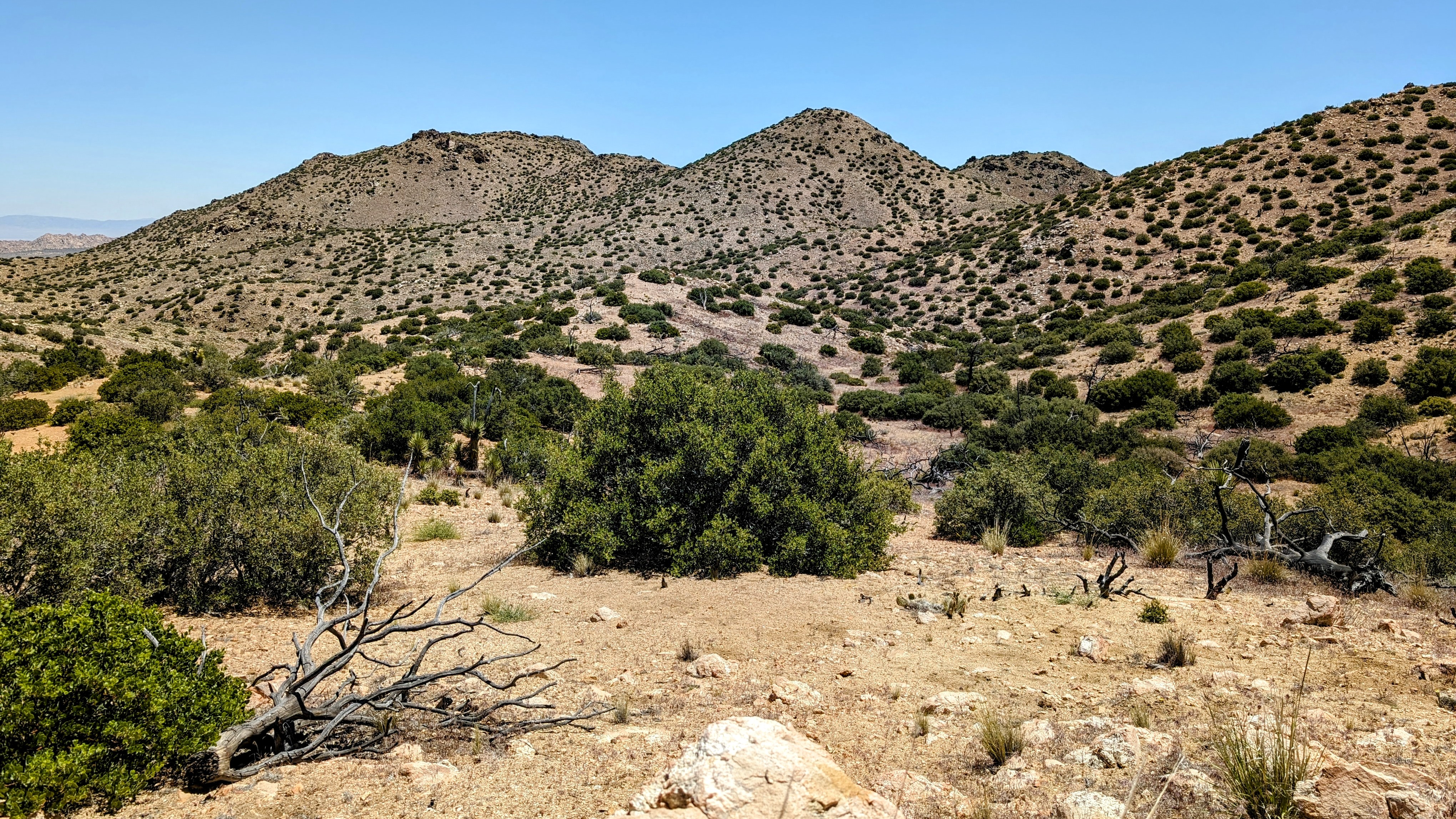
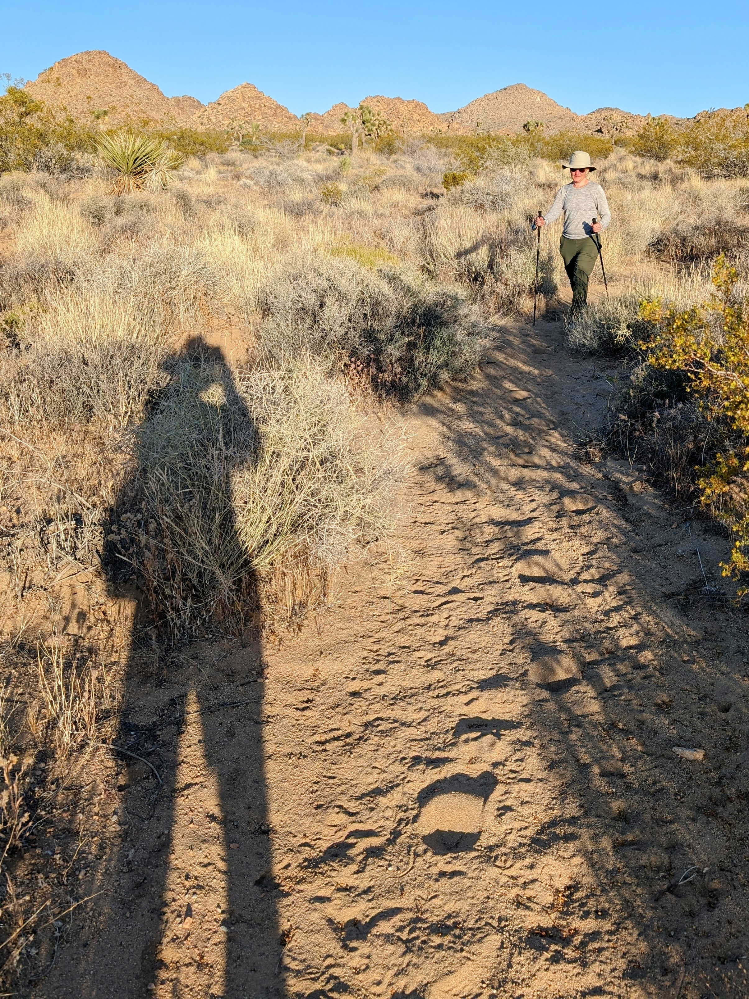
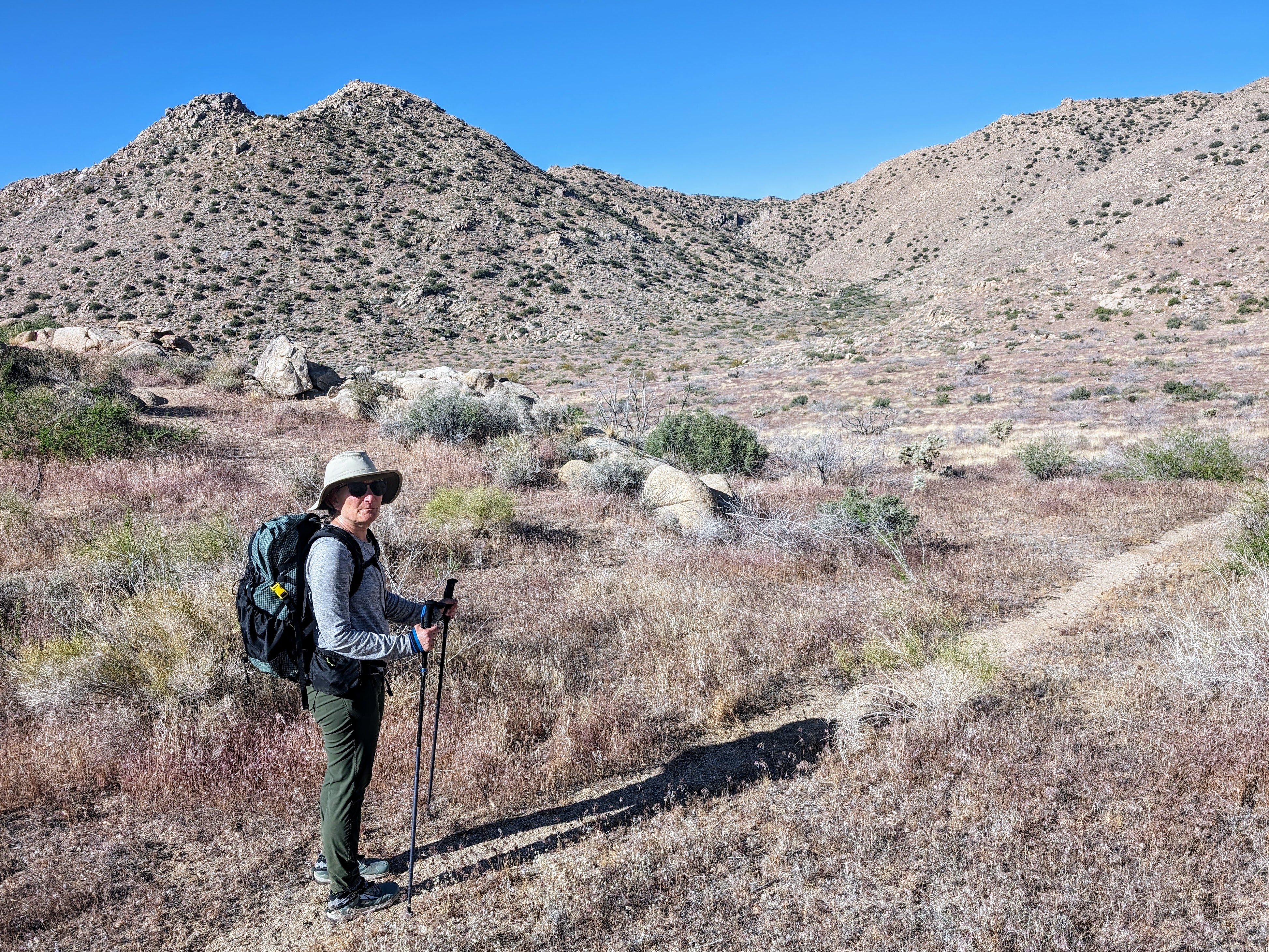
We started at Covington Flats, which is quite deep in the park down a dirt road. We were the only ones parked at the trailhead. We then started south on the California Riding and Hiking Trail.
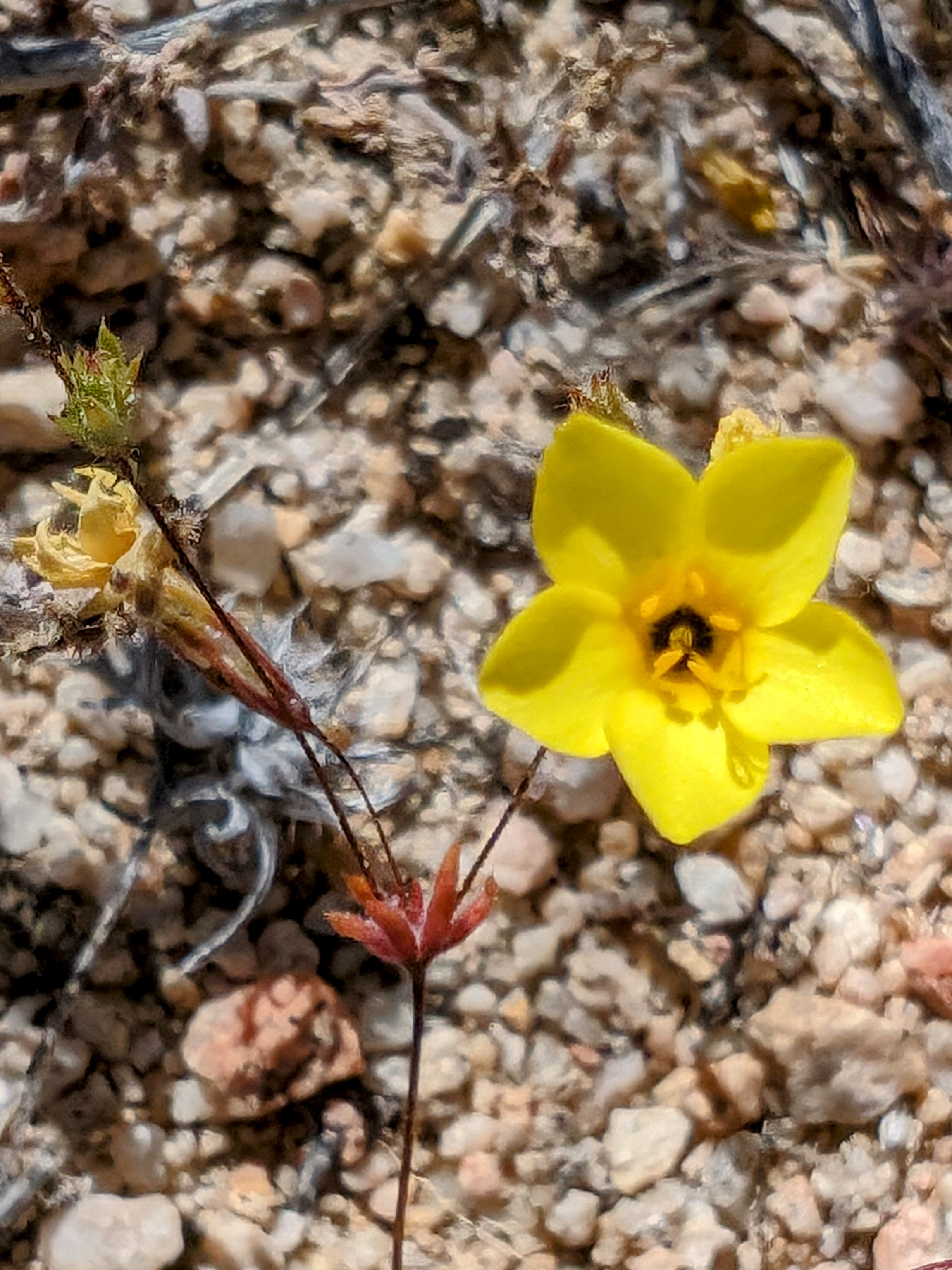
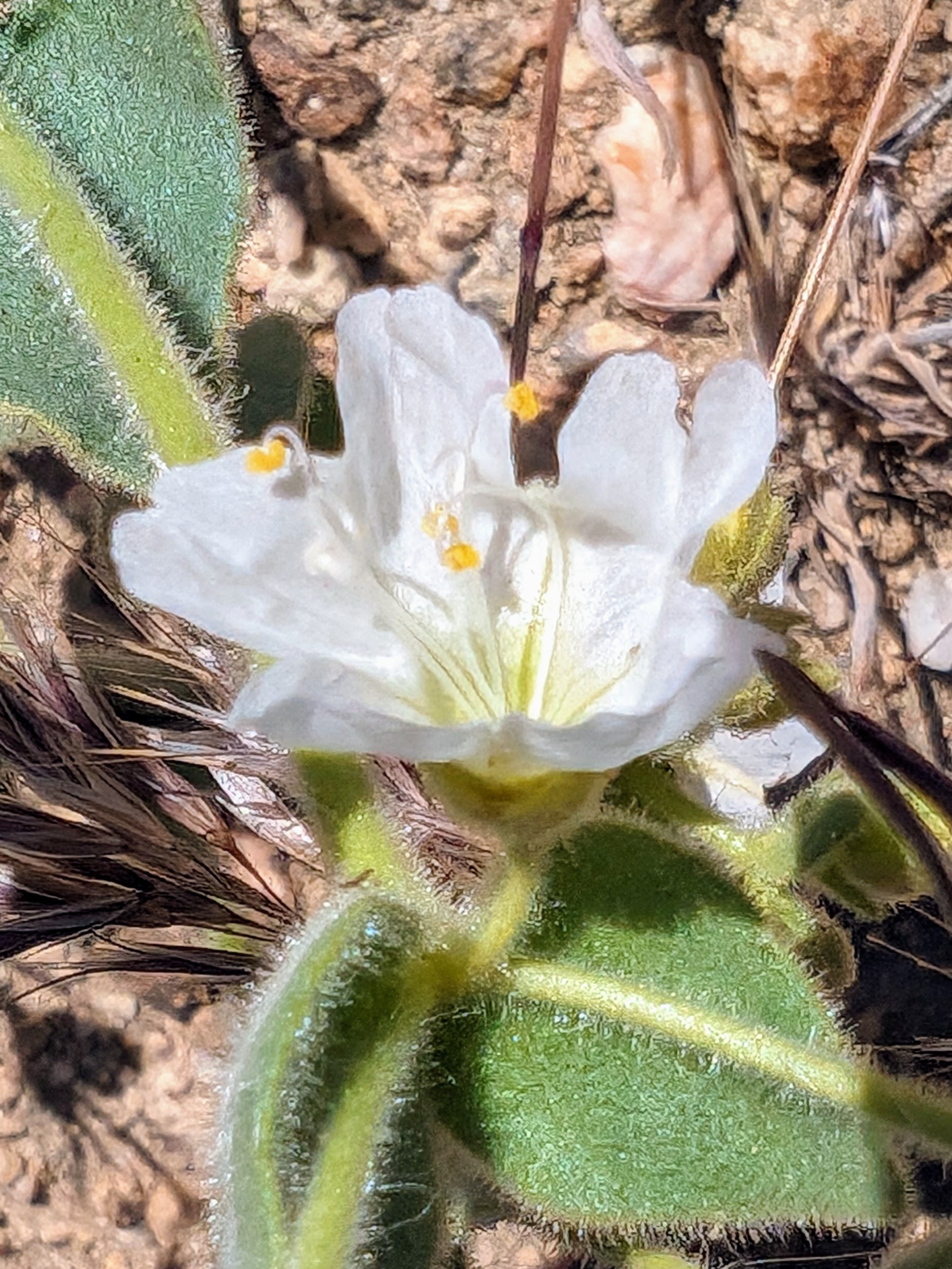
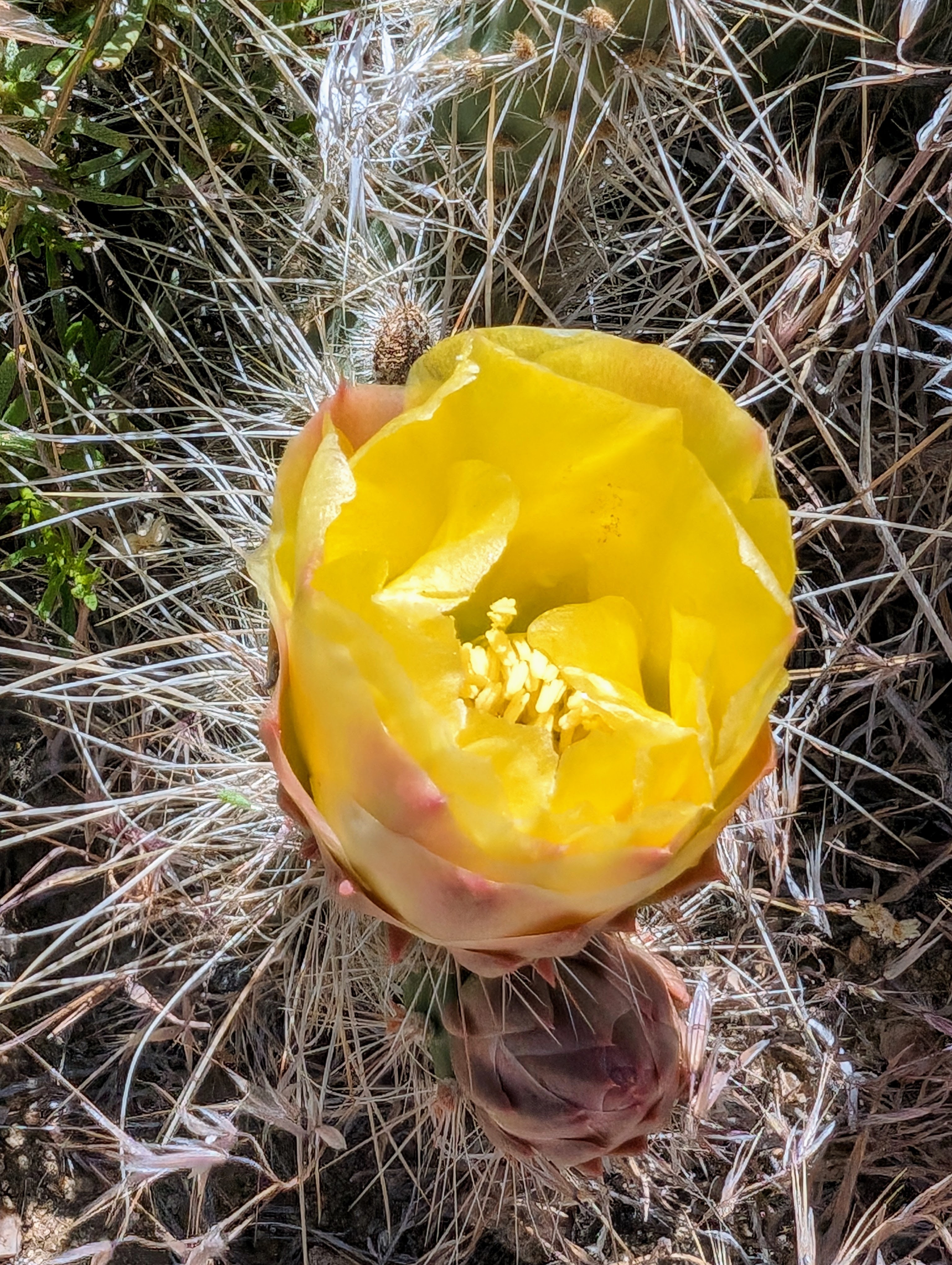
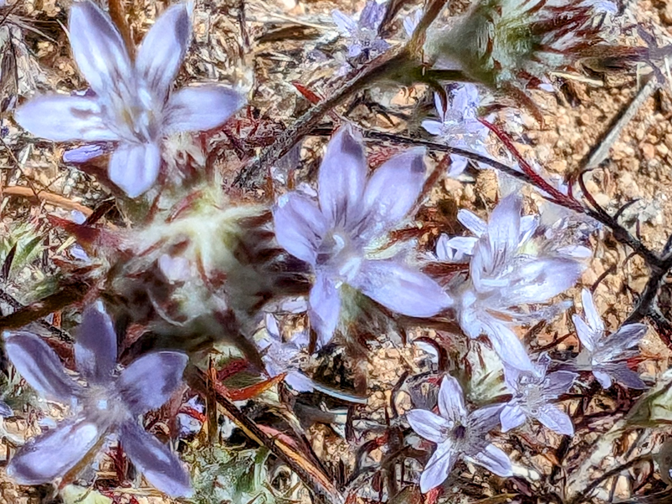
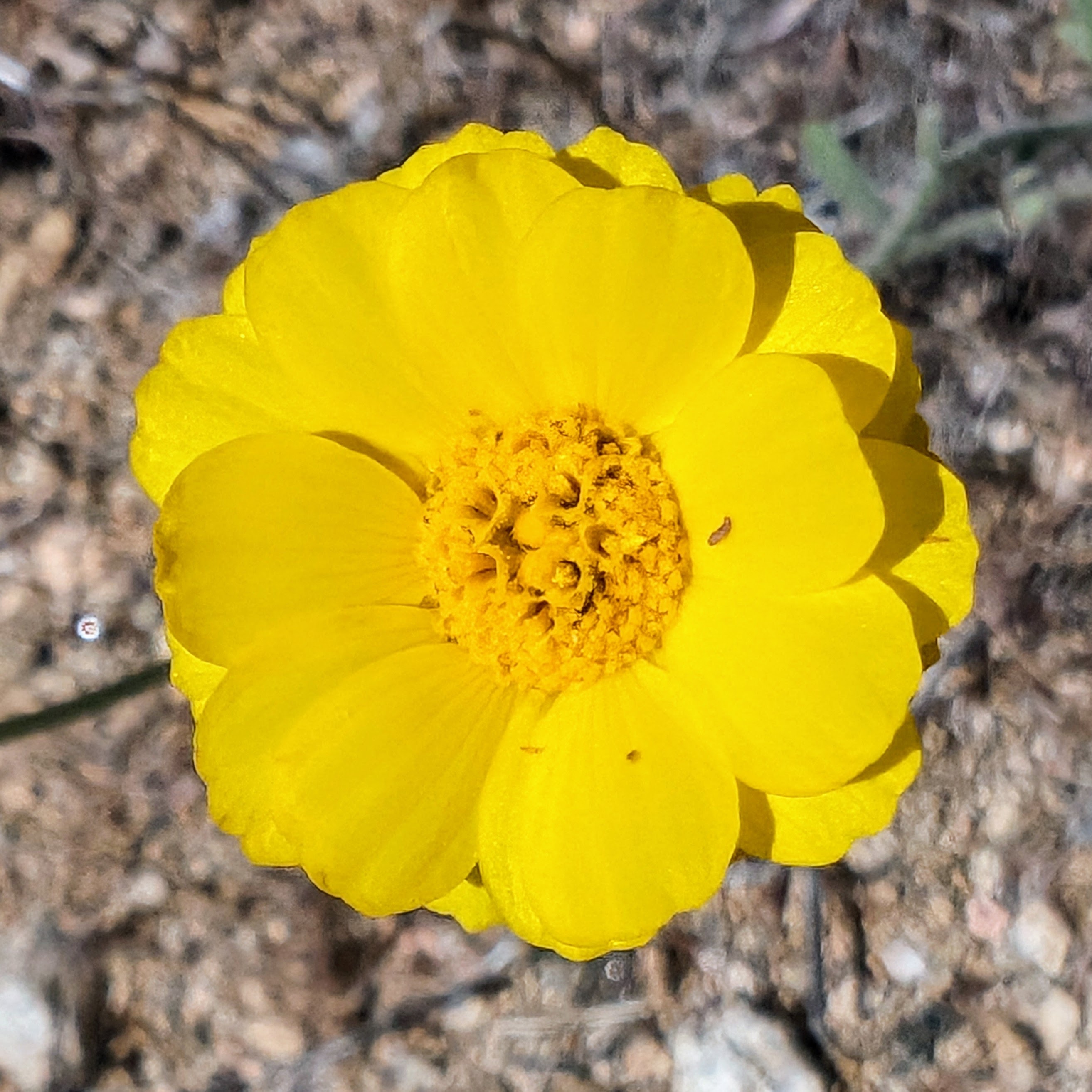
The flowers were amazing at this elevation!
![pxl_20240525_165445205](https://jimmyjamhikingclub.com/wp-content/uploads/2024/05/pxl_20240525_165445205.jpg)
![pxl_20240525_1655438152](https://jimmyjamhikingclub.com/wp-content/uploads/2024/05/pxl_20240525_1655438152.jpg)
![pxl_20240525_1656201922](https://jimmyjamhikingclub.com/wp-content/uploads/2024/05/pxl_20240525_1656201922.jpg)
![pxl_20240525_1656439752](https://jimmyjamhikingclub.com/wp-content/uploads/2024/05/pxl_20240525_1656439752.jpg)
![pxl_20240525_1657550592](https://jimmyjamhikingclub.com/wp-content/uploads/2024/05/pxl_20240525_1657550592.jpg)
![pxl_20240525_1659212882](https://jimmyjamhikingclub.com/wp-content/uploads/2024/05/pxl_20240525_1659212882.jpg)
![pxl_20240525_170611965](https://jimmyjamhikingclub.com/wp-content/uploads/2024/05/pxl_20240525_170611965.jpg)
![pxl_20240525_1707353082](https://jimmyjamhikingclub.com/wp-content/uploads/2024/05/pxl_20240525_1707353082.jpg)
![pxl_20240525_1712504502](https://jimmyjamhikingclub.com/wp-content/uploads/2024/05/pxl_20240525_1712504502.jpg)
![pxl_20240525_1714049192](https://jimmyjamhikingclub.com/wp-content/uploads/2024/05/pxl_20240525_1714049192.jpg)
![pxl_20240525_1716059422](https://jimmyjamhikingclub.com/wp-content/uploads/2024/05/pxl_20240525_1716059422.jpg)
![pxl_20240525_1716510662](https://jimmyjamhikingclub.com/wp-content/uploads/2024/05/pxl_20240525_1716510662.jpg)
![pxl_20240525_1729483962](https://jimmyjamhikingclub.com/wp-content/uploads/2024/05/pxl_20240525_1729483962.jpg)
![pxl_20240525_1731399742](https://jimmyjamhikingclub.com/wp-content/uploads/2024/05/pxl_20240525_1731399742.jpg)
![pxl_20240525_1734403682](https://jimmyjamhikingclub.com/wp-content/uploads/2024/05/pxl_20240525_1734403682.jpg)
![pxl_20240525_1806069042](https://jimmyjamhikingclub.com/wp-content/uploads/2024/05/pxl_20240525_1806069042.jpg)
We turned north to follow a wash and then a use trail headed towards Quail Mountain.
![pxl_20240525_1824035312](https://jimmyjamhikingclub.com/wp-content/uploads/2024/05/pxl_20240525_1824035312.jpg)
![pxl_20240525_1824487032](https://jimmyjamhikingclub.com/wp-content/uploads/2024/05/pxl_20240525_1824487032.jpg)
![pxl_20240525_1826411542](https://jimmyjamhikingclub.com/wp-content/uploads/2024/05/pxl_20240525_1826411542.jpg)
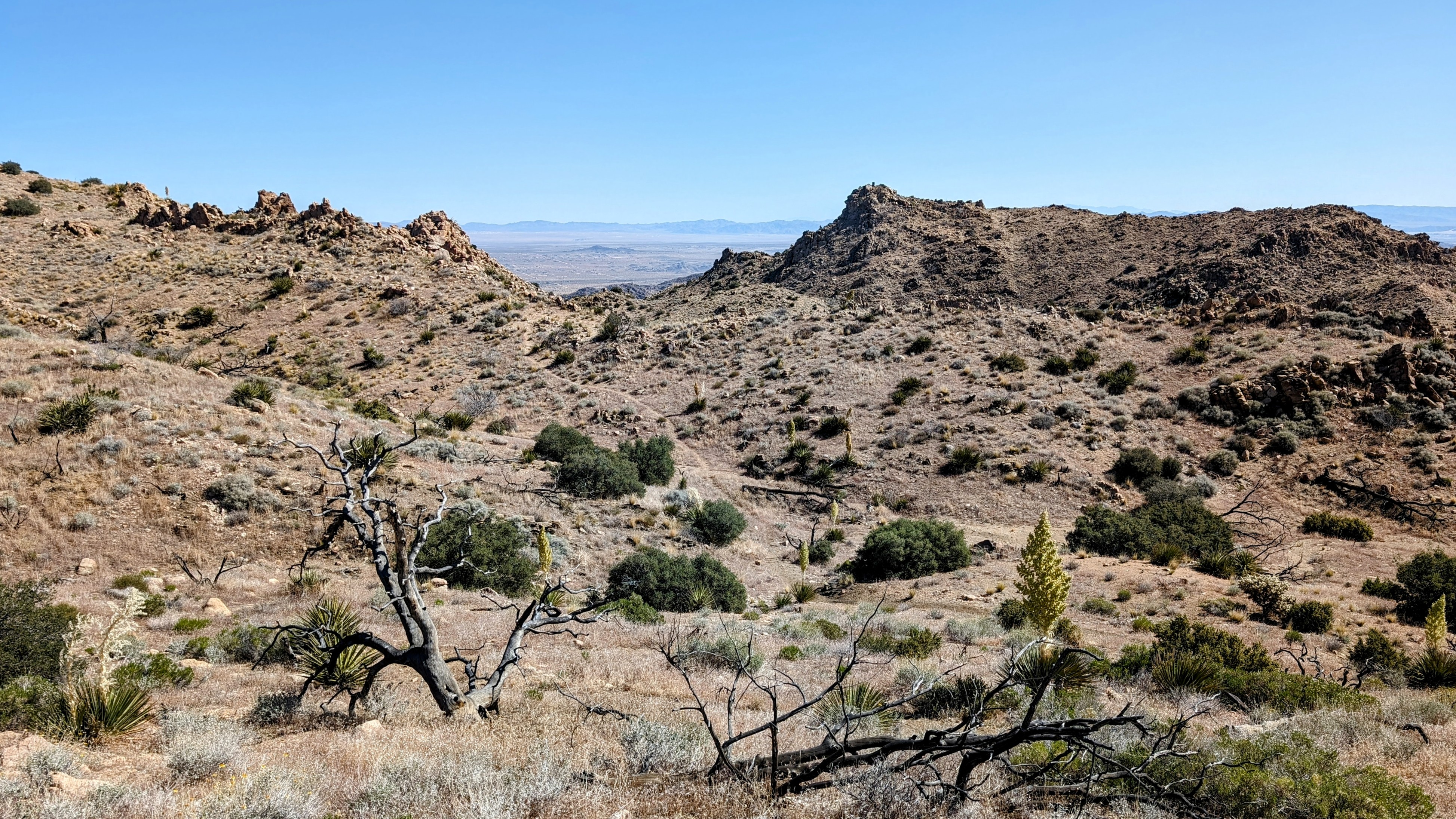
The use trail climbed out of a wash and headed steeply up a ridge.
![pxl_20240525_1834060382](https://jimmyjamhikingclub.com/wp-content/uploads/2024/05/pxl_20240525_1834060382.jpg)
Soon we made the ridge and had a clear view of Quail Mountain.
![pxl_20240525_1901581572](https://jimmyjamhikingclub.com/wp-content/uploads/2024/05/pxl_20240525_1901581572.jpg)
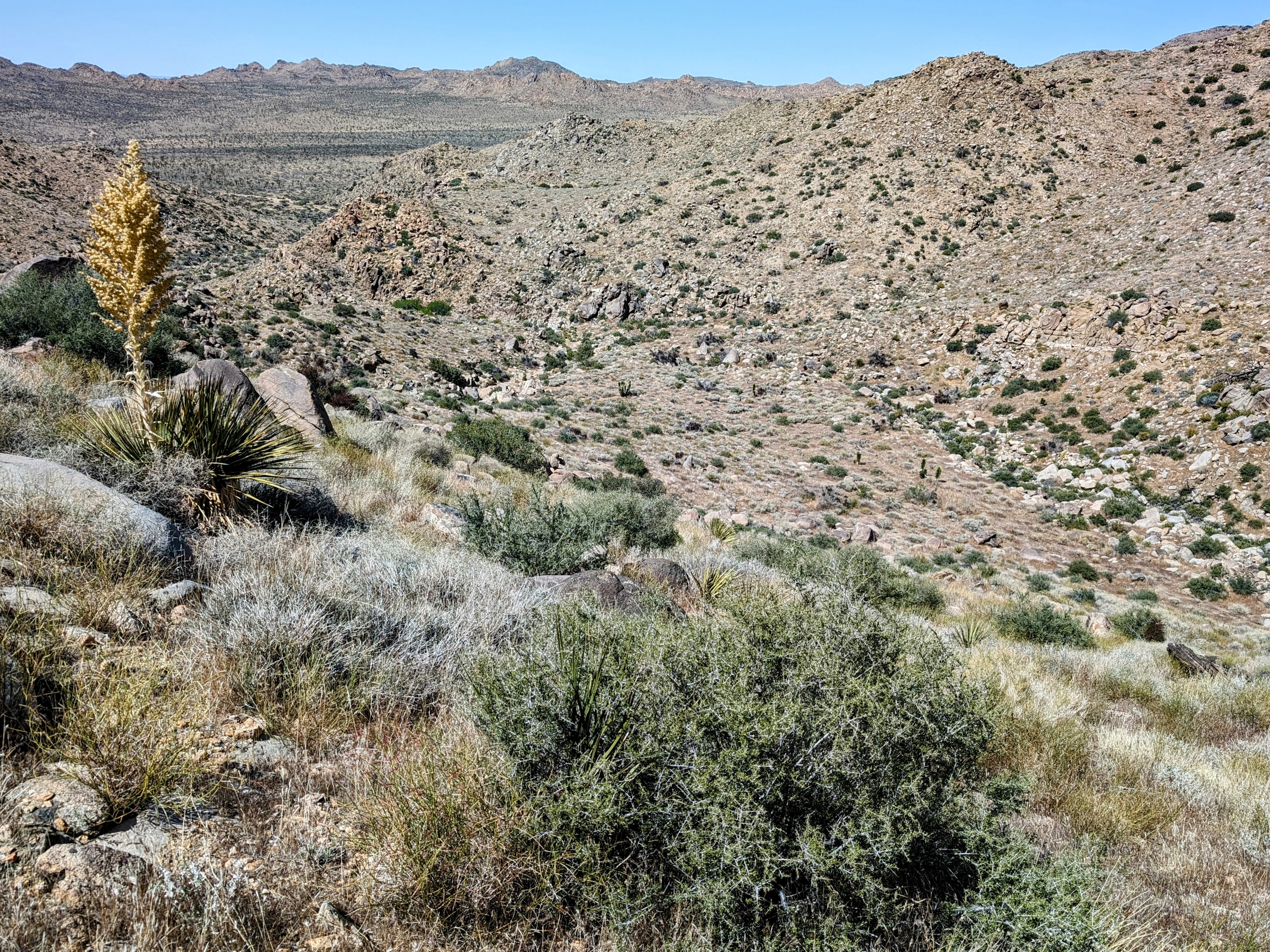
On seeing the scenery, we changed our plan to summit Quail and decided to head down towards Samuelson’s Rock instead. I’m not sure I would do it this way again. It added about 2 miles of cross country to our route, and the terrain was complex. It took a lot more time than I expected.
![pxl_20240525_1928050372](https://jimmyjamhikingclub.com/wp-content/uploads/2024/05/pxl_20240525_1928050372.jpg)
![pxl_20240525_1954549722](https://jimmyjamhikingclub.com/wp-content/uploads/2024/05/pxl_20240525_1954549722.jpg)
![pxl_20240525_2006355892](https://jimmyjamhikingclub.com/wp-content/uploads/2024/05/pxl_20240525_2006355892.jpg)
![pxl_20240525_2014089582](https://jimmyjamhikingclub.com/wp-content/uploads/2024/05/pxl_20240525_2014089582.jpg)
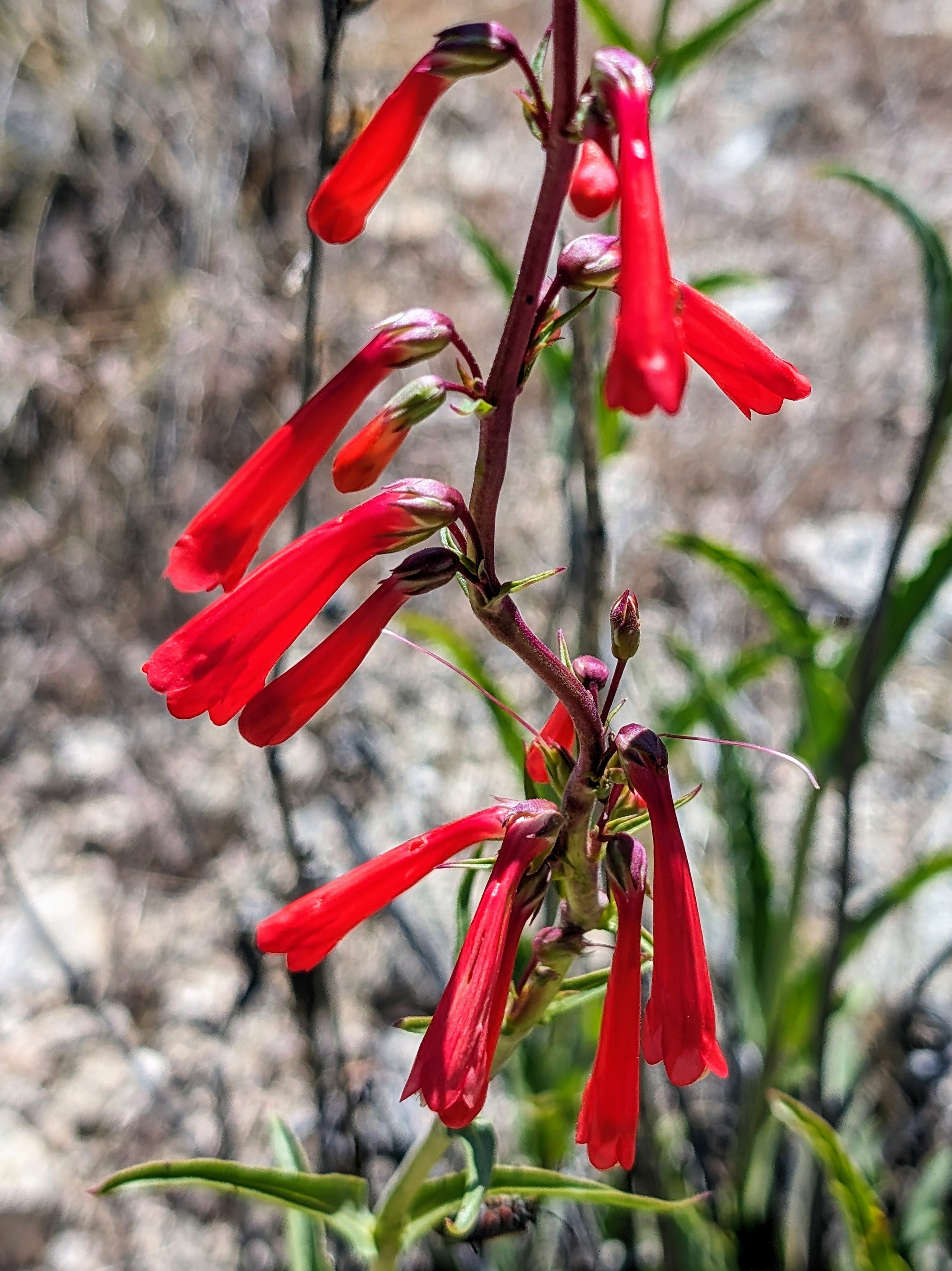
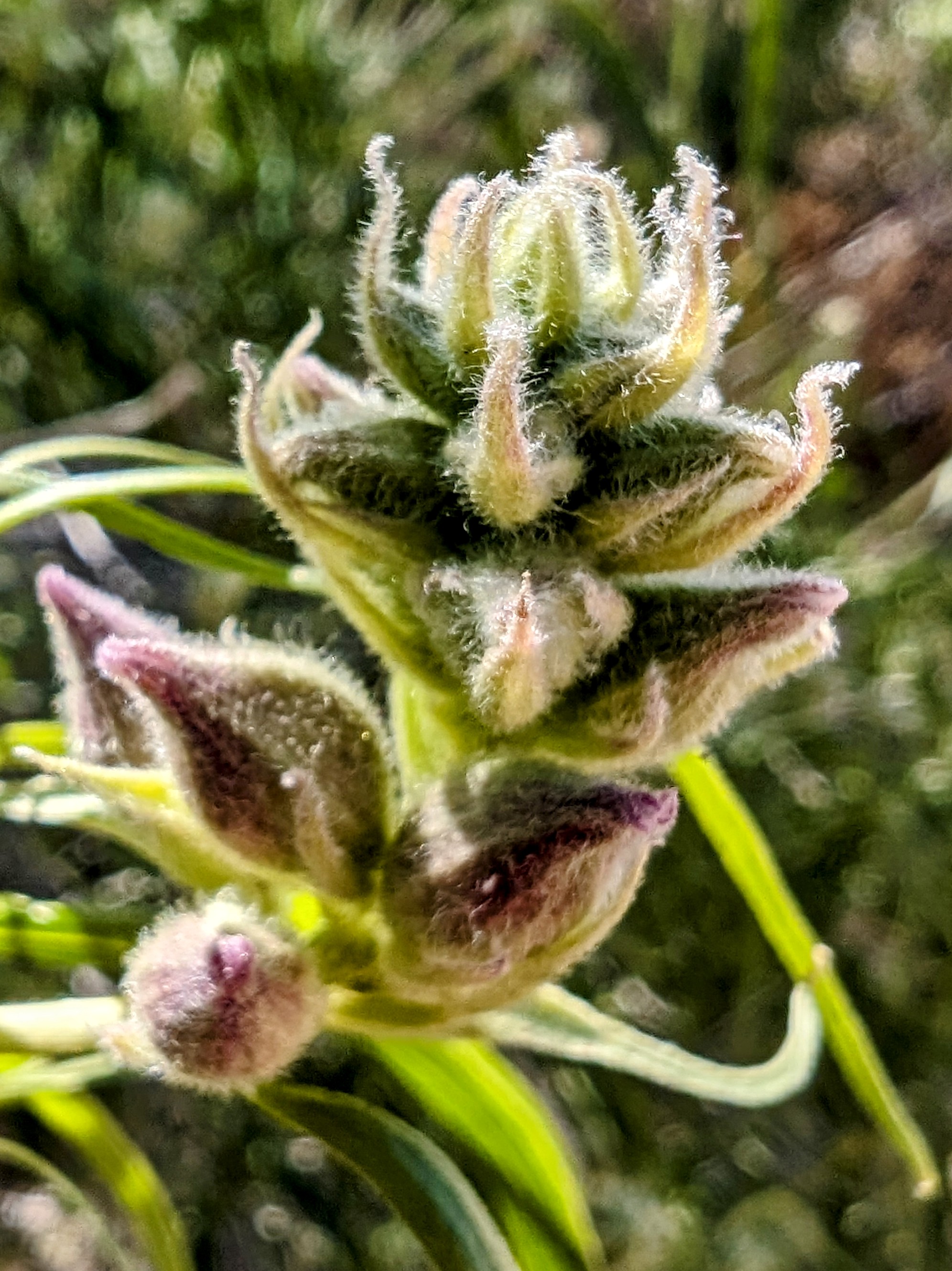
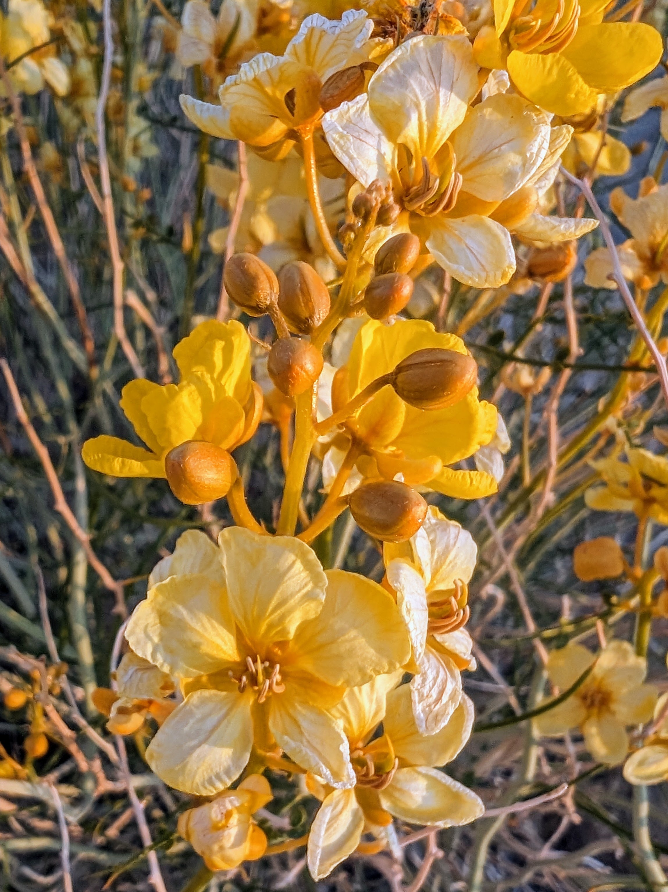
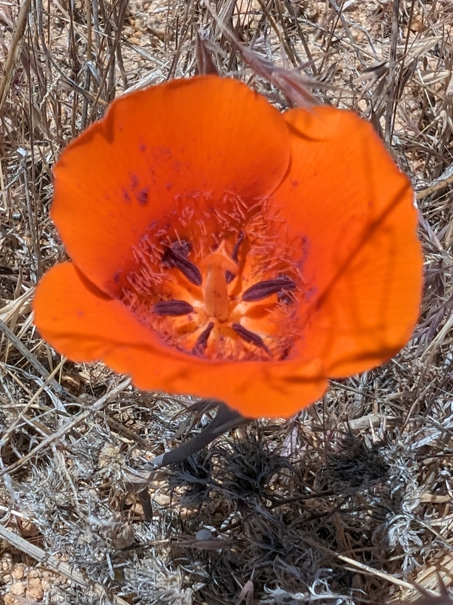
I found my favorite flower in the whole world!
![pxl_20240525_2114125742](https://jimmyjamhikingclub.com/wp-content/uploads/2024/05/pxl_20240525_2114125742.jpg)
![pxl_20240525_2115480292](https://jimmyjamhikingclub.com/wp-content/uploads/2024/05/pxl_20240525_2115480292.jpg)
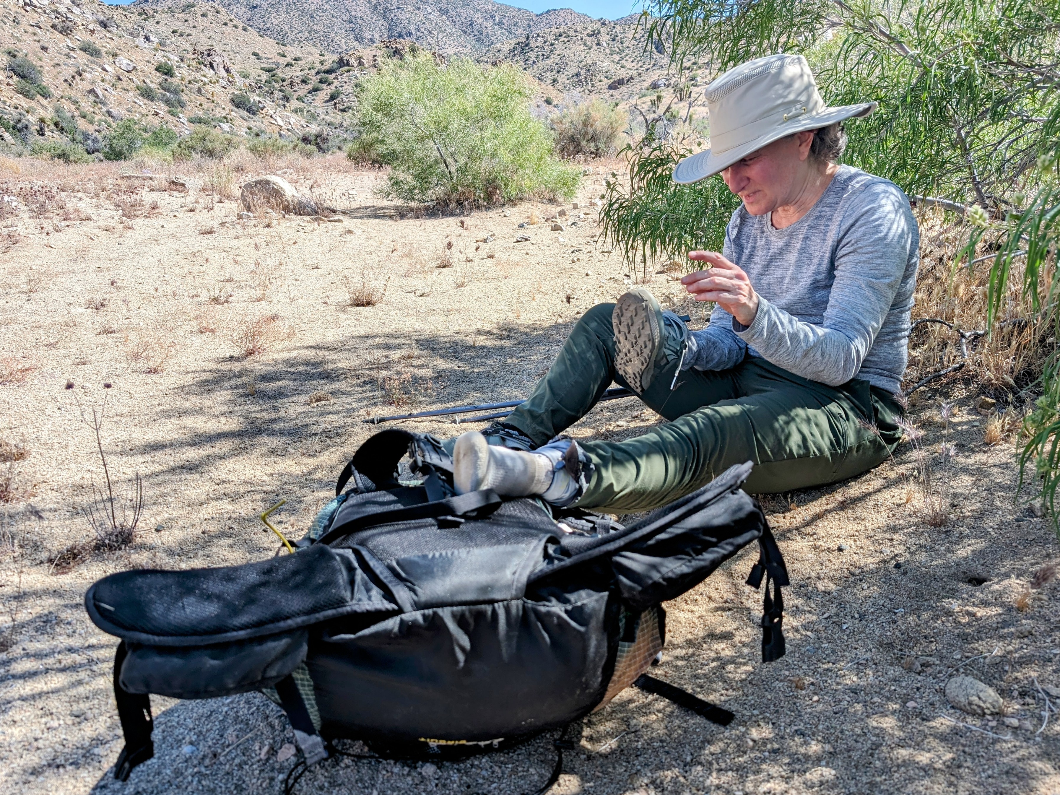
The heat really got to Half Cookie, so we took a long break under a juniper and I carried her pack for a little while.
![pxl_20240525_2154130592](https://jimmyjamhikingclub.com/wp-content/uploads/2024/05/pxl_20240525_2154130592.jpg)
![pxl_20240525_2206421052](https://jimmyjamhikingclub.com/wp-content/uploads/2024/05/pxl_20240525_2206421052.jpg)
![pxl_20240525_2211263972](https://jimmyjamhikingclub.com/wp-content/uploads/2024/05/pxl_20240525_2211263972.jpg)
![pxl_20240525_2220397462](https://jimmyjamhikingclub.com/wp-content/uploads/2024/05/pxl_20240525_2220397462.jpg)
![pxl_20240525_2225023442](https://jimmyjamhikingclub.com/wp-content/uploads/2024/05/pxl_20240525_2225023442.jpg)
![pxl_20240525_2235282632](https://jimmyjamhikingclub.com/wp-content/uploads/2024/05/pxl_20240525_2235282632.jpg)
We found shade and took a nice long break to pick all the prickly stickers and grasses out of our socks and shoes.
![pxl_20240525_2243507732](https://jimmyjamhikingclub.com/wp-content/uploads/2024/05/pxl_20240525_2243507732.jpg)
![pxl_20240525_2239051772](https://jimmyjamhikingclub.com/wp-content/uploads/2024/05/pxl_20240525_2239051772.jpg)
![pxl_20240525_2257097532](https://jimmyjamhikingclub.com/wp-content/uploads/2024/05/pxl_20240525_2257097532.jpg)
![pxl_20240525_2308051602](https://jimmyjamhikingclub.com/wp-content/uploads/2024/05/pxl_20240525_2308051602.jpg)
After the break Half Cookie was feeling better. We followed the wash northwest of Quail Mountain down to where it intersected with Quail Wash. We then headed upslope and crossed over to Samuelson Rock.
![pxl_20240525_2319086422](https://jimmyjamhikingclub.com/wp-content/uploads/2024/05/pxl_20240525_2319086422.jpg)
![pxl_20240525_2340198002](https://jimmyjamhikingclub.com/wp-content/uploads/2024/05/pxl_20240525_2340198002.jpg)
![pxl_20240525_2343245802](https://jimmyjamhikingclub.com/wp-content/uploads/2024/05/pxl_20240525_2343245802.jpg)
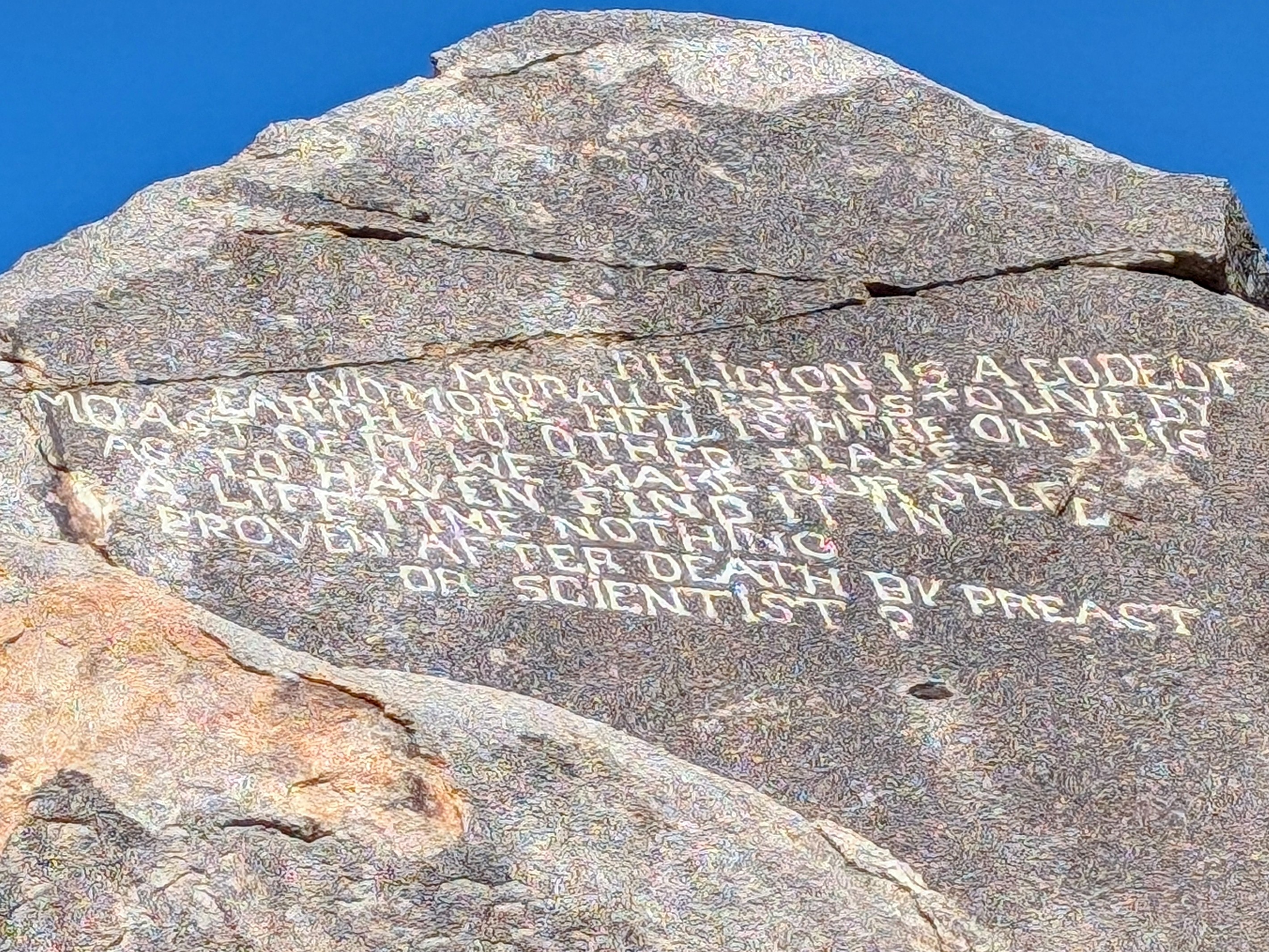
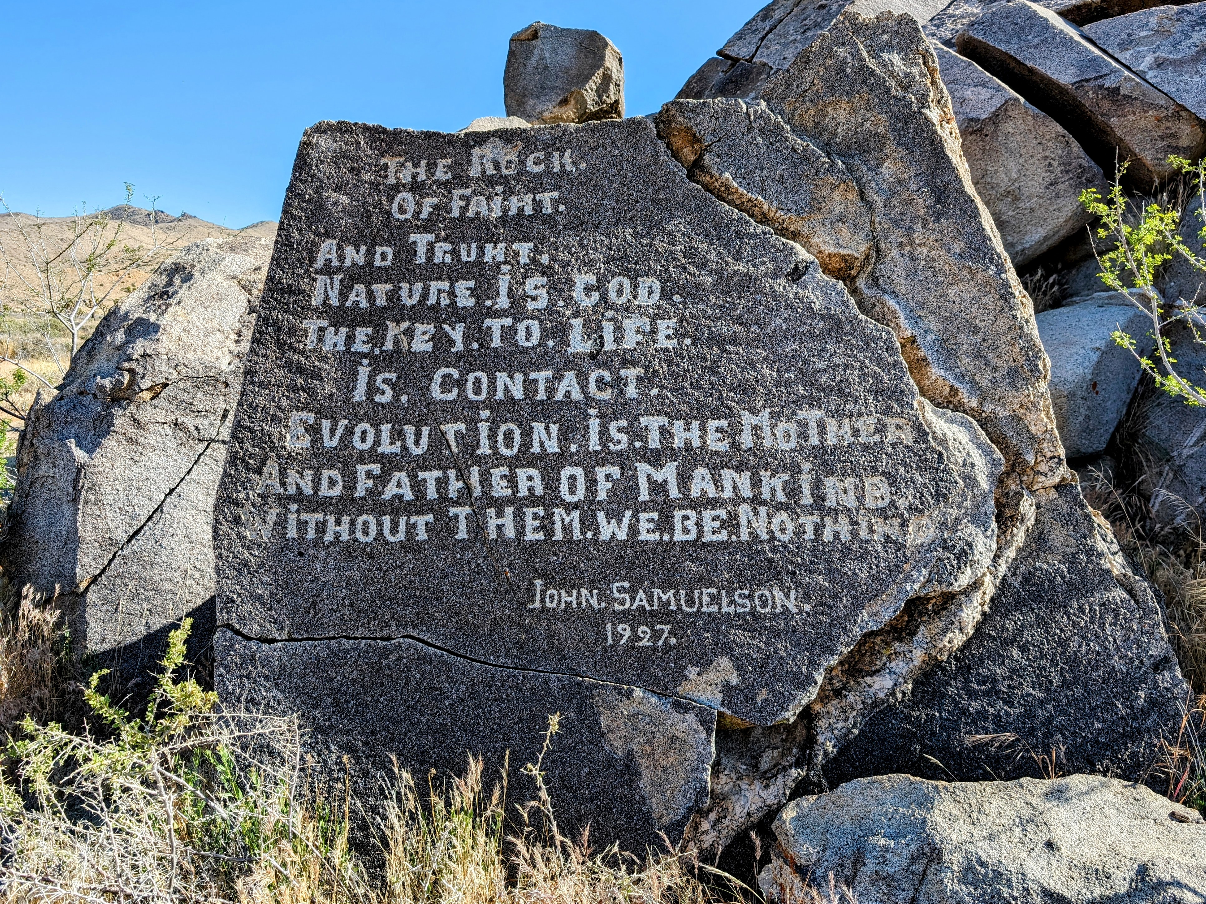
Samuelson’s Rock is weird. A homesteader lived here long ago, and he carved misspelled wisdom for the ages.
![pxl_20240525_2347558542](https://jimmyjamhikingclub.com/wp-content/uploads/2024/05/pxl_20240525_2347558542.jpg)
![pxl_20240525_2351454212](https://jimmyjamhikingclub.com/wp-content/uploads/2024/05/pxl_20240525_2351454212.jpg)
![pxl_20240525_2352315872](https://jimmyjamhikingclub.com/wp-content/uploads/2024/05/pxl_20240525_2352315872.jpg)
![pxl_20240525_2354195402](https://jimmyjamhikingclub.com/wp-content/uploads/2024/05/pxl_20240525_2354195402.jpg)
We picked up the Bigfoot Trail here, which was quite a relief after our cross country adventure.
![pxl_20240526_0019297272](https://jimmyjamhikingclub.com/wp-content/uploads/2024/05/pxl_20240526_0019297272.jpg)
![pxl_20240526_005731739](https://jimmyjamhikingclub.com/wp-content/uploads/2024/05/pxl_20240526_005731739.jpg)
![pxl_20240526_0058207722](https://jimmyjamhikingclub.com/wp-content/uploads/2024/05/pxl_20240526_0058207722.jpg)
About a mile and a half from the West Entrance we set up our tent and then headed to the ranger station to fill our water bottles.
![pxl_20240526_0158274942](https://jimmyjamhikingclub.com/wp-content/uploads/2024/05/pxl_20240526_0158274942.jpg)
It was a little jarring to hit the road. I thought it would be nice to walk the shoulder, but it’s very narrow and it was full of Memorial Day Weekend traffic. We ended up travelling cross country on a parallel route.
After we got water we found a broad wash to walk back on. It was nice but the sun was setting and we were both VERY tired!
![pxl_20240526_0234036322](https://jimmyjamhikingclub.com/wp-content/uploads/2024/05/pxl_20240526_0234036322.jpg)
![pxl_20240526_0256261362](https://jimmyjamhikingclub.com/wp-content/uploads/2024/05/pxl_20240526_0256261362.jpg)
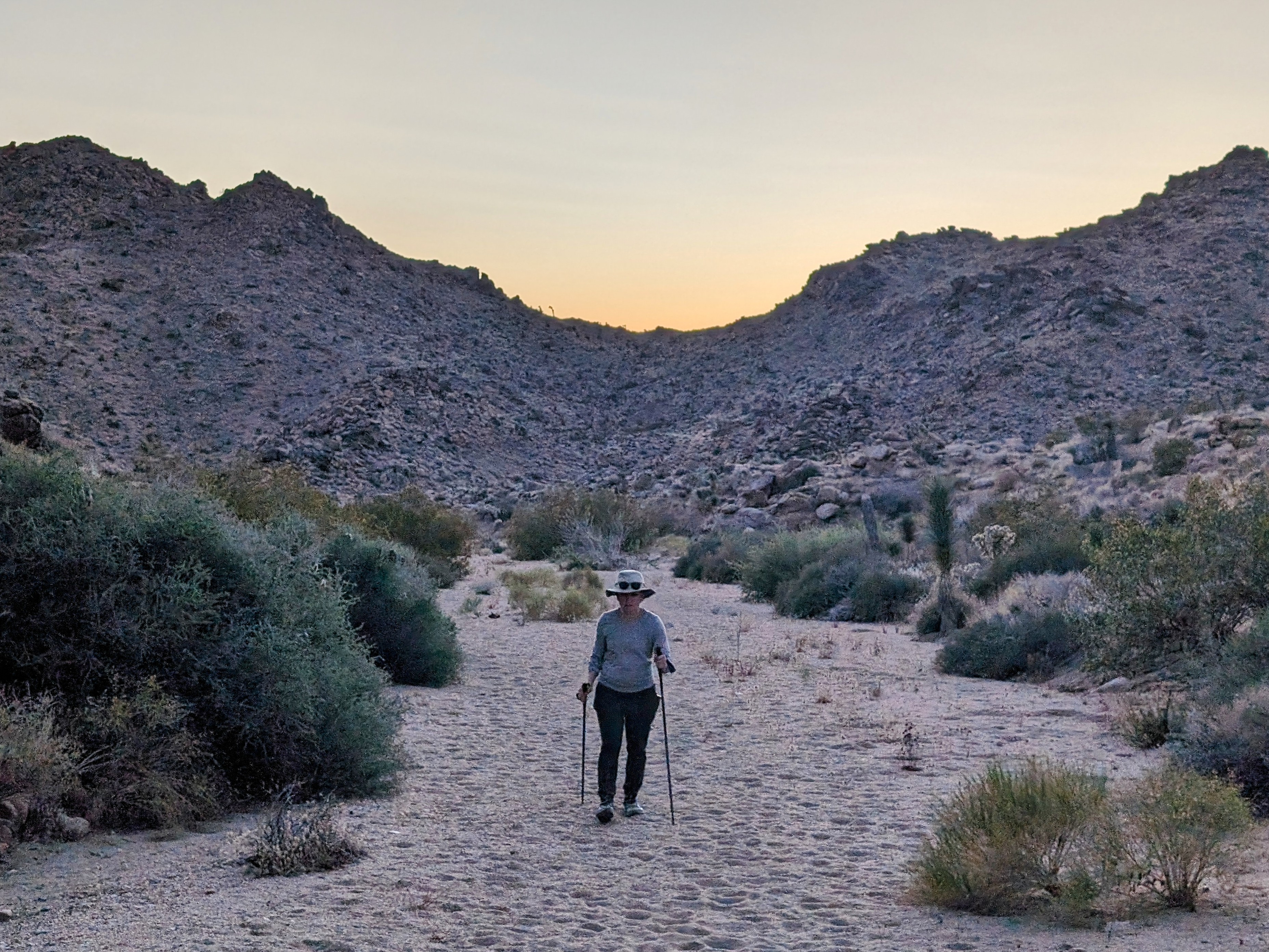
We had a warm night in the tent (I forgot to take a picture!) and the next morning we got an early start.
The first order of business was to beautify the neighborhood.
![pxl_20240526_1336246472](https://jimmyjamhikingclub.com/wp-content/uploads/2024/05/pxl_20240526_1336246472.jpg)
![pxl_20240526_1358154092](https://jimmyjamhikingclub.com/wp-content/uploads/2024/05/pxl_20240526_1358154092.jpg)
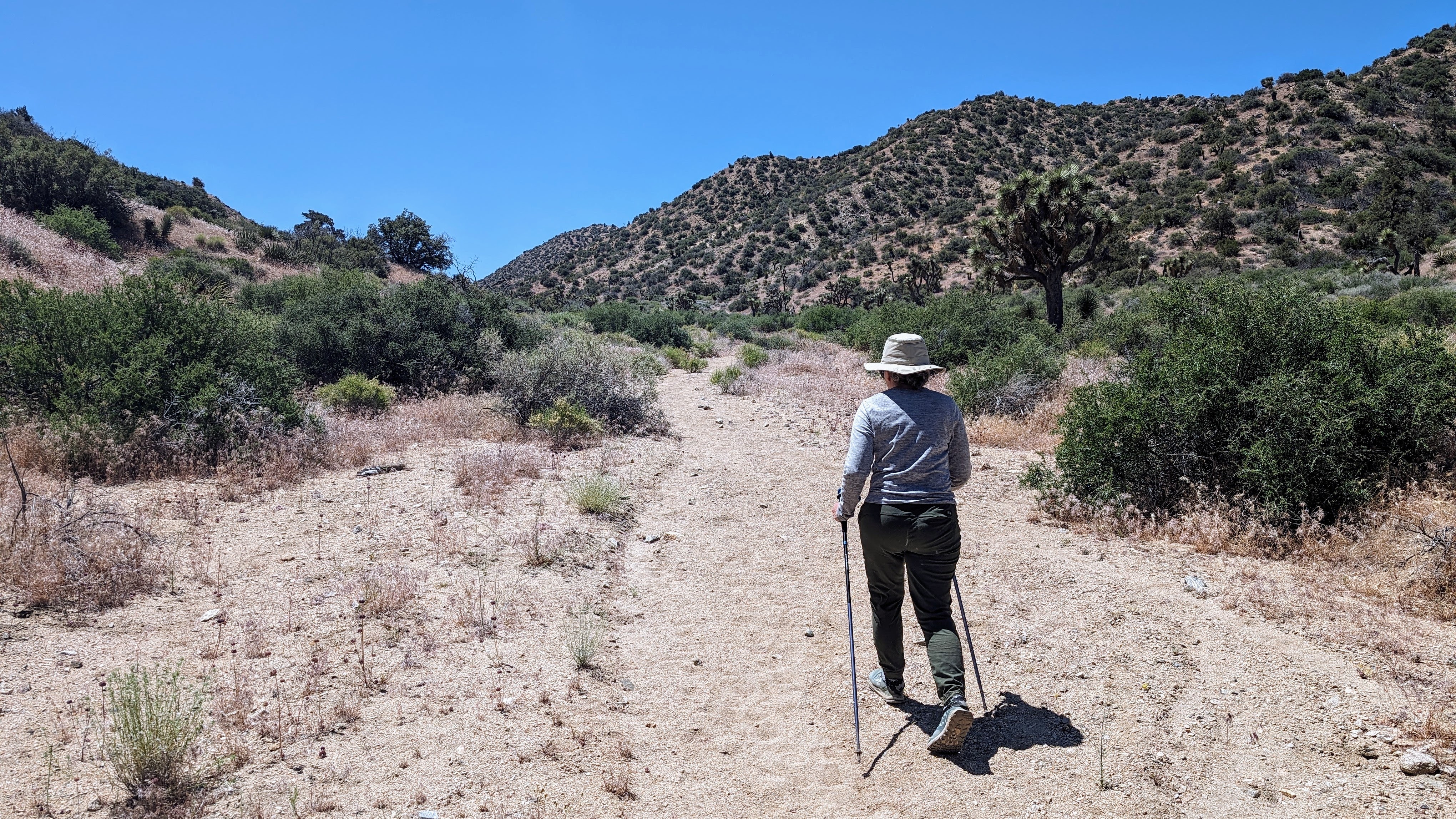
The Bigfoot Trail crossed over Quail Wash, but we decided to hike the wash instead.
![pxl_20240526_1411187752](https://jimmyjamhikingclub.com/wp-content/uploads/2024/05/pxl_20240526_1411187752.jpg)
Eventually we picked up the Bigfoot Trail again.
![pxl_20240526_1424257032](https://jimmyjamhikingclub.com/wp-content/uploads/2024/05/pxl_20240526_1424257032.jpg)
![pxl_20240526_1506395412](https://jimmyjamhikingclub.com/wp-content/uploads/2024/05/pxl_20240526_1506395412.jpg)
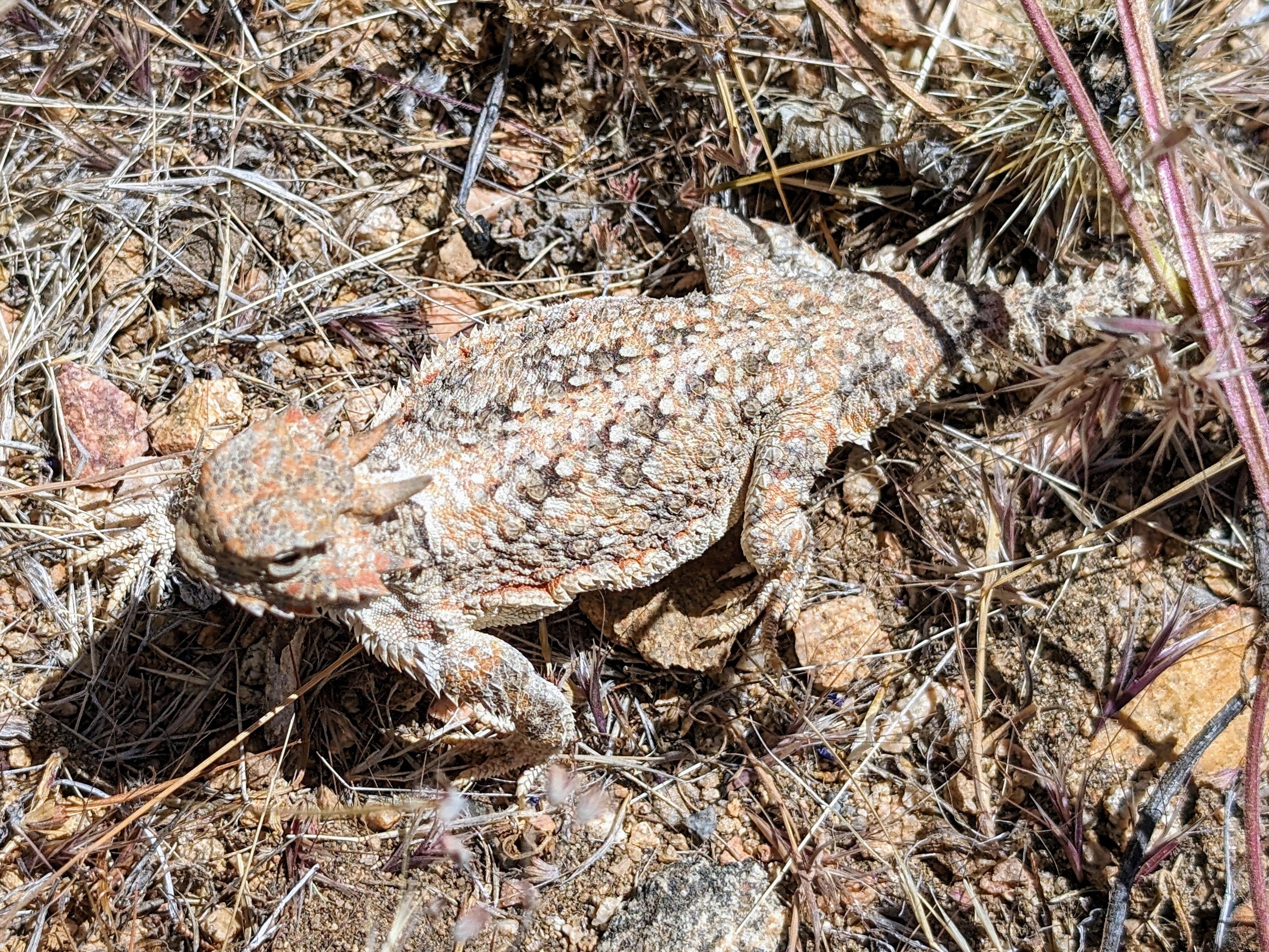
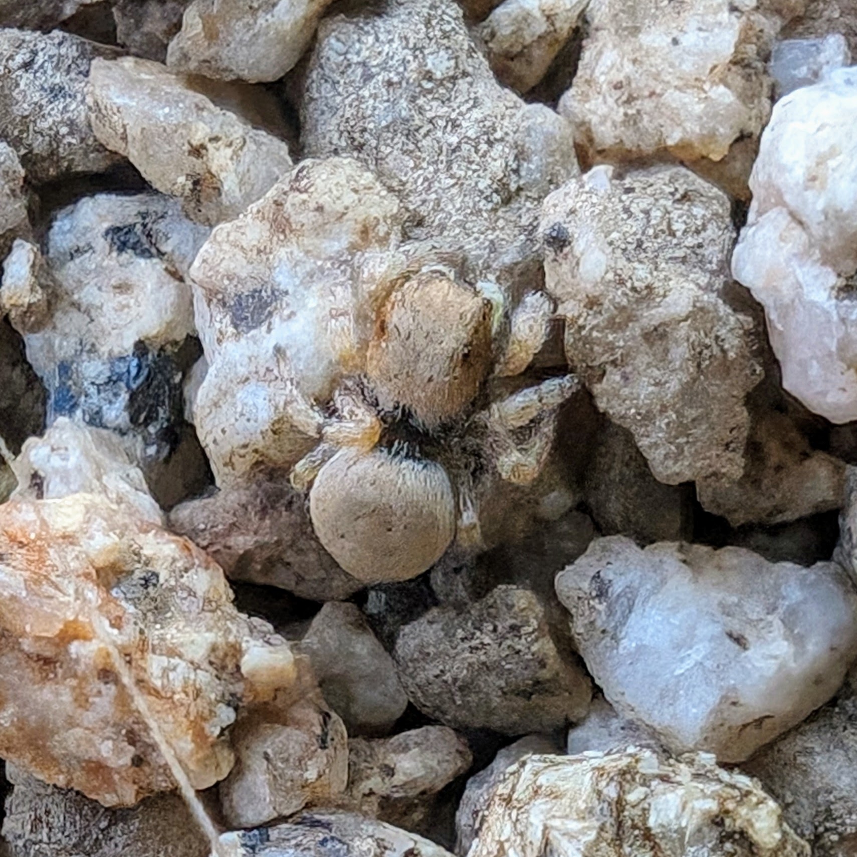
We had a thousand foot climb early in the morning, and as we turned a switchback I heard Half Cookie exclaim. I thought it was a rattlesnake, but it was even better.
A desert tortoise!
![pxl_20240526_1519065942](https://jimmyjamhikingclub.com/wp-content/uploads/2024/05/pxl_20240526_1519065942.jpg)
I have probably hiked 1,000 miles in the desert and this is the first time I have ever seen one of these guys.
The tortoise noticed us observing it and slowly turned off trail, swimming into the dry grass along its edge.
![pxl_20240526_1519232382](https://jimmyjamhikingclub.com/wp-content/uploads/2024/05/pxl_20240526_1519232382.jpg)
That encounter made the whole trip for me. So awesome!
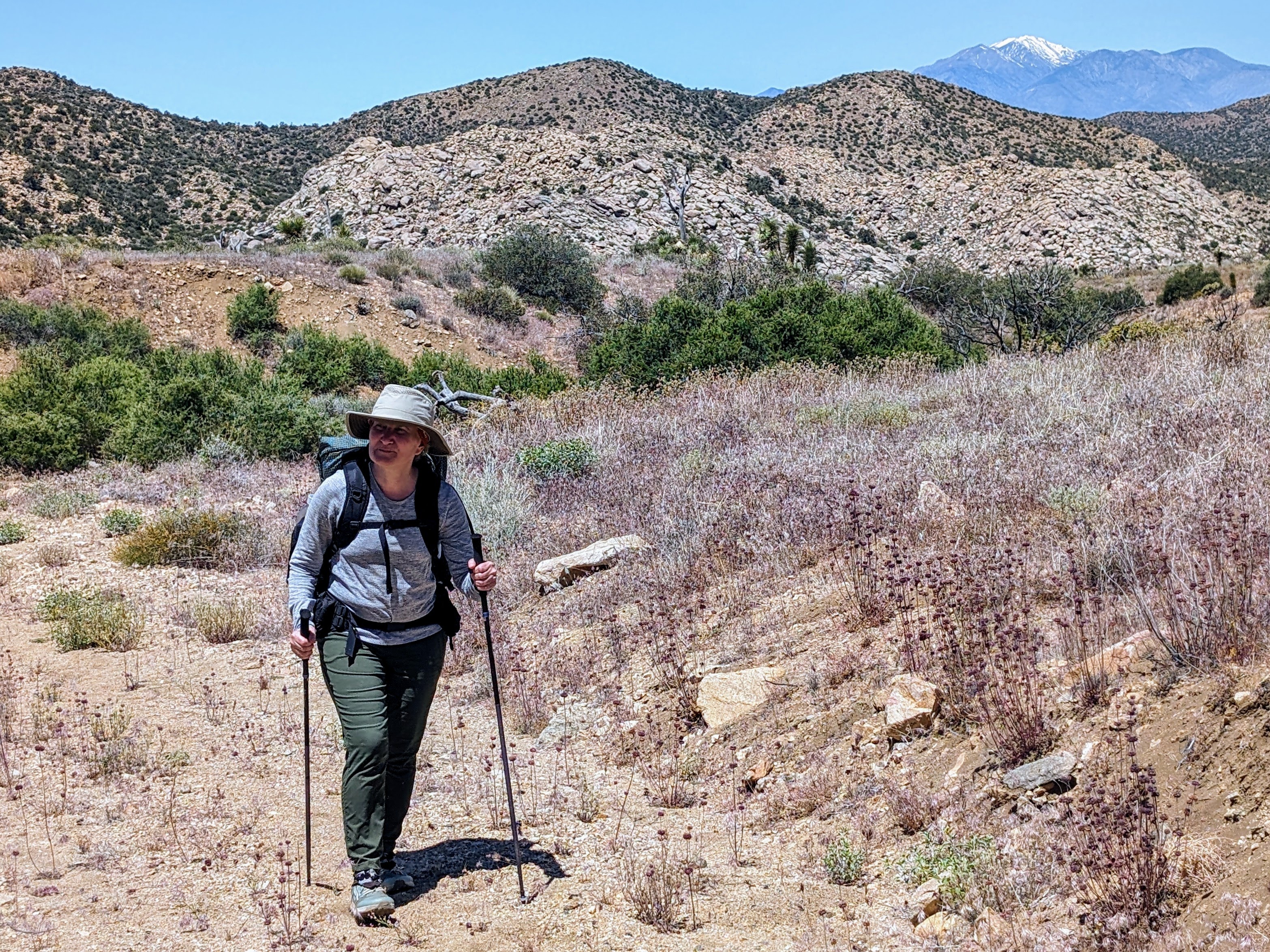
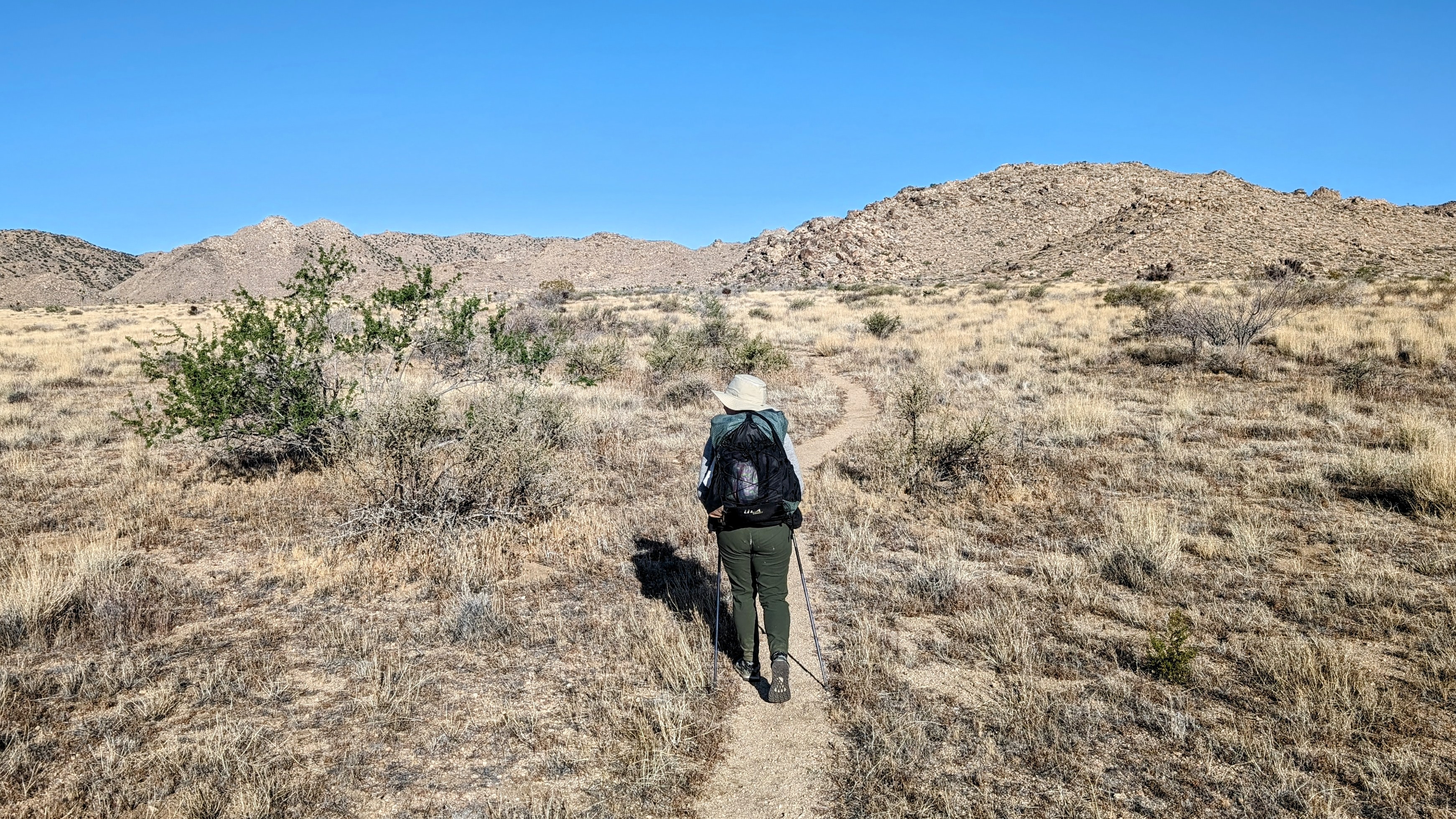
We continued climbing the Bigfoot Trail across complex terrain, playing a guessing game: how many more ridges would we climb before we came to the top?
![pxl_20240526_1622009162](https://jimmyjamhikingclub.com/wp-content/uploads/2024/05/pxl_20240526_1622009162.jpg)
![pxl_20240526_1658336402](https://jimmyjamhikingclub.com/wp-content/uploads/2024/05/pxl_20240526_1658336402.jpg)
At Convington Flat road we decided to slackpack, dropping everything but food, water, and first aid into one pack and leaving it there to pick up in the car on the way out. It made the last 7 miles a lot nicer!
![pxl_20240526_1711329322](https://jimmyjamhikingclub.com/wp-content/uploads/2024/05/pxl_20240526_1711329322.jpg)
![pxl_20240526_1717152332](https://jimmyjamhikingclub.com/wp-content/uploads/2024/05/pxl_20240526_1717152332.jpg)
![pxl_20240526_1725089332](https://jimmyjamhikingclub.com/wp-content/uploads/2024/05/pxl_20240526_1725089332.jpg)
![pxl_20240526_1726149762](https://jimmyjamhikingclub.com/wp-content/uploads/2024/05/pxl_20240526_1726149762.jpg)
![pxl_20240526_1746122942](https://jimmyjamhikingclub.com/wp-content/uploads/2024/05/pxl_20240526_1746122942.jpg)
I wasn’t sure what we would find when we turned off the Bigfoot Trail and up the last wash, but it turns out that route is the California Riding and Hiking Trail. It was wide, sandy, easy walking all the way up. We passed the first other hikers we have seen the whole trip.
![pxl_20240526_1822024652](https://jimmyjamhikingclub.com/wp-content/uploads/2024/05/pxl_20240526_1822024652.jpg)
And when we were back at Covington Road, we found that the CRHT continued on a lovely track far enough away from the road that it was out of sight.
![pxl_20240526_1920372082](https://jimmyjamhikingclub.com/wp-content/uploads/2024/05/pxl_20240526_1920372082.jpg)
![pxl_20240526_200633479](https://jimmyjamhikingclub.com/wp-content/uploads/2024/05/pxl_20240526_200633479.jpg)
When we got back to the car we were very tired.
So tired, that we reminded each other: don’t forget to pick up our things we left on the side of the road!
But it was nice to be back in the comfort of a modern car again, and on our way home.